The UK Overseas Territory of the Pitcairn Islands is a chain of four small islands (Pitcairn, Oeno, Henderson and Ducie). The islands run west northwest to east southeast through the central South Pacific and have an exclusive economic zone (EEZ) of nearly 842,000 km2, with only 0.0001% land area (47 km2). The islands lie within the nutrient poor surface waters of the South Pacific Subtropical Gyre.
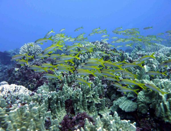
Pitcairn Island is volcanic with steep, rocky coastlines exposed to large ocean swells. Henderson Island is formed from a raised coral reef, and Oeno and Ducie are low coral atolls. Biodiversity around the islands is high and the marine area is one of the least impacted in the Pacific region. To maintain healthy ecosystems, the Pitcairn Islands Marine Protected Area was established in September 2016, covering the whole EEZ. It is one of the largest MPAs in the world.
Climate change is projected to impact the central south Pacific Ocean environment through widespread warming of waters, altered circulation (e.g. strengthening of the South Pacific Gyre), increased stratification (limiting vertical supply of nutrients to the surface) decreasing concentrations of dissolved oxygen, decreasing aragonite saturation state (ocean acidification) and rising sea levels. These changes to the ocean climate will impact species, ecosystems, food webs and dependent communities in the Pitcairn Islands.
On average, sea surface temperature (SST) in the Pacific Ocean increased by 0.31°C between 1950 and 2009, with monitoring sites in the Pitcairn Islands recording three marine heatwaves, in recent decades (1995, 2006 and 2017). Sea surface temperature could increase by more than 3°C by 2100 in the Pacific region due to climate change (under a high carbon emissions scenario), producing cascading effects on sea level, dissolved oxygen levels, net primary productivity, and pH. Sea level rise is projected to accelerate over the 21st Century and it is unclear whether the islands shorelines can adapt.
Important sectors, such as fisheries and tourism, will be affected by these changes, as will food and water security and essential services, such as energy, import of supplies, coastal protection, and community access to natural resources.
From an initial long list of impacts on biodiversity and society for this region, three priority climate change issues were identified by a regional working group of scientific experts and policymakers:
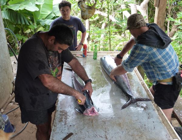
There are several projects in the Pitcairn Islands that are considering nature-based solutions, mainly in marine and coastal environments. A Darwin initiative project targeted the facilitation of informed sustainable marine resource decision-making by the Government of the Pitcairn Islands. The project created local capacity for fisheries and environmental assessments and developed a marine management plan with the Pitcairn Island community and the UK government for fisheries.
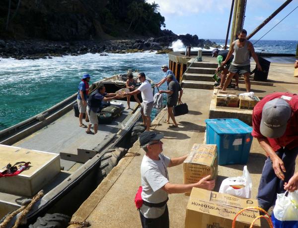
Since then, the Blue Belt Programme has assisted the Government of the Pitcairn Islands to develop an MPA Management Plan, developed seabed maps to minimise the risk of anchor damage, assisted with the development of a whale watching code of conduct and provided assistance through satellite surveillance for illegal, unregulated and unreported (IUU) fishing.
The INTEGRE project provided support for integrated coastal management in the Pitcairn Islands. An action plan was developed in close collaboration with the islanders, to improve waste management, limit erosion, better manage fisheries resources, control invasive species, and promote commercial development.
Downscaled climate change projections are not currently available for the Pitcairn Islands and future scenarios are based on global and regional scale model outputs. Localised projections would allow more focused management plans to be devised.
Historic monitoring is sparce and carried out opportunistically, thus baseline data on coral cover, fish biomass and trends are limited. Fish catch data and marine habitat monitoring are required to support sustainable fisheries and MPA management.
Regular monitoring would provide a baseline to determine the extent of current impacts from non-climatic stressors that could be managed to build the resilience of the ecosystem to climate threats. Marine habitat monitoring could also provide an early warning of impacts, such as coral bleaching, crown-of-thorns starfish outbreaks and coral diseases and inform responsive management.
The implications of climate change for coastal infrastructure and security of shipping also warrants further examination. Information on the location and condition of existing infrastructure, building standards that have been applied and future infrastructure plans is required to determine the areas of greatest risk.
Please cite this information as Johnson, J.E., Dutra, L., Starling, G., Lehodey, P., Loubster, D. and Nicol, S. Eds Howes, E.L. and Buckley, P. (2021) Summary - key climate change effects on the coastal and marine environment around the Pacific UK Overseas Territories. MCCIP Science Report Card 2021.
MCCIP wishes to acknowledge the contributions of the Pacific Region Workshop participants who helped to identify the priority climate change issues: Valerie Allain (SPC), Simeon Archer Rand (Cefas), Johann Bell (ANCORS) and Mark McGuiness (Foreign Commonwealth and Development Office).